


Earthquakes in the Red Sea between Sudan and Saudi Arabia
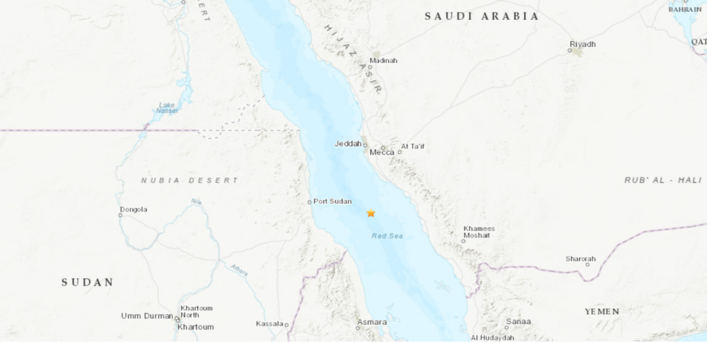
Location of the earthquakes in the Red Sea today (Map: US Geological Survey)
The US Geological Survey (USGS) announced today that two strong earthquakes were recorded in the Red Sea near the coasts of Sudan and Saudi Arabia today.
The USGS stated on its website that the first earthquake about 197 km northeast of Tokar town in Sudan’s Red Sea state, measured 4.7 on the Richter scale.
The second quake, about 174 km northeast of Tokar, measured 4.2 on the Richter scale.
The official spokesman for the Sudanese government quoted the Saudi Geological Survey, which stated that seismic monitoring stations recorded an earthquake in the middle of the Red Sea, 161 km west of the Al Laith governorate at a depth of 10.4 km at exactly 12:09 today.
So far, there have been no reports from Saudi Arabia and Sudan of losses caused by the earthquakes.
Red Sea Rift
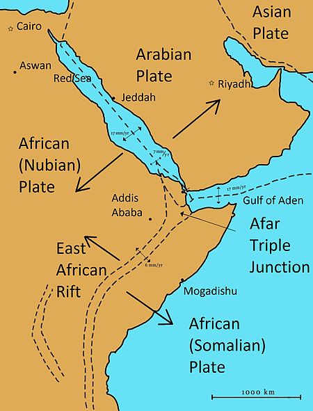
The fault line in the Red Sea is a ridge between two tectonic plates, the African Plate and the Arabian Plate. The divergence between these plates formed the Red Sea Rift. Magnetic anomalies suggest that the spreading rate on either side of the Red Sea is about one centimetre per year.
More than 90 per cent of the seismicity in the Red Sea are believed to be volcanic related, according to Dr Zuhair Hasan El Isa of the University of Jordan.
The largest earthquakes of the last few decades in the region, however, show that two faults are active in support of a divergent environment between the Arabian and African plates,” El Isa stated in his study in 2015.


 and then